Scan to BIM Technical Reference: Workflow, Deliverables and Tooling
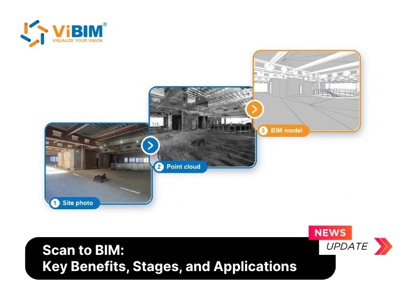
This reference summarizes how a scan to BIM project is structured, what the modeling stage consumes and produces, and which tools sit at each step. Scan to BIM converts 3D laser scan data (a point cloud) into an intelligent Building Information Model (BIM) of an existing building.
Definitions
- Point cloud: scan data made of a dense field of measured X, Y, Z points.
- Registration: aligning individual scans into a single unified point cloud, based on common targets or shared geometric features.
- LOD (level of development): the detail level agreed for model elements, for example LOD 200 for broad planning or LOD 300 for detailed design.
- LOI (level of information): the amount of data attached to model elements.
- As-built BIM model: the model of the building as it currently stands.
Workflow stages
| Stage |
Activity |
Typical owner |
| 1 |
Identify requirements: scope, LOD, LOI, tolerance, disciplines |
Project stakeholders |
| 2 |
Plan scanner positions, set point density, capture the site |
Scanning company |
| 3 |
Register scans, filter noise, produce a clean cloud |
Scanning company |
| 4 |
Model the registered cloud in Revit |
Modeling team |
Inputs to the modeling stage
- Indexed Autodesk ReCap files (.RCP or .RCS) are preferred for data integrity. E57 is also accepted.
- Large datasets move over a secure FTP server or cloud platforms such as Box, Google Drive and ACC.
- Individual RCS files stay under 5 GB, or the dataset is packed as a single compressed .zip.
Modeling steps
- Data input and transfer.
- Bidding and planning: every element is checked against the required LOD, LOI and tolerance, and scope ambiguity is resolved before scheduling.
- Execution and modeling in Revit across Architecture, Structure, MEP and Topography.
- Quality assurance: a two-layer independent check of geometry and parameters, then a measurement of model deviation against the original point cloud.
- Deliverables.
Deliverables
.RVT — editable Revit model..IFC — interchange file for other BIM platforms..DWG — AutoCAD 2D as-built drawings.
Toolchain
| Tool |
Role |
| Autodesk Revit |
BIM authoring |
| Autodesk ReCap Pro |
Opening and indexing the registered point cloud |
| Navisworks Manage |
Quality control and clash detection |
| Autodesk Construction Cloud |
Collaboration and data sharing |
| AutoCAD |
2D drawings and documentation |
Known constraints
- Mobile scanners such as the Leica BLK2GO record at a lower density than terrestrial scanners, which limits the achievable level of detail.
- Registration error left in the cloud carries into every element modeled from it.
- Automation helps with registration, surface classification and repetitive family placement through Revit API and Dynamo scripts. Irregular, one-off geometry still needs a modeler.
Reference: https://vibimglobal.com/blog/what-is-scan-to-bim/
See more:
ViBIM
10th floor, CIT Building, No 6, Valley 15, Duy Tan street, Cau Giay ward, Hanoi, Vietnam
(+84) 944.798.298
https://vibimglobal.com/