
ViBIM Topography BIM Modeling Services for Existing Sites
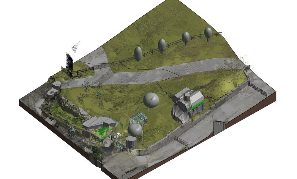
Topography BIM modeling extends a Scan to BIM project past the building envelope, turning the scanned ground around a building into a Revit site model. We build it for survey firms and BIM managers whose clients need parking areas, walkways, driveways, courtyards and landscaped slopes in the same coordinate system as the building. The deliverable is a native RVT site model, with DWG site drawings taken from it on request.
The site, sorted by surface type
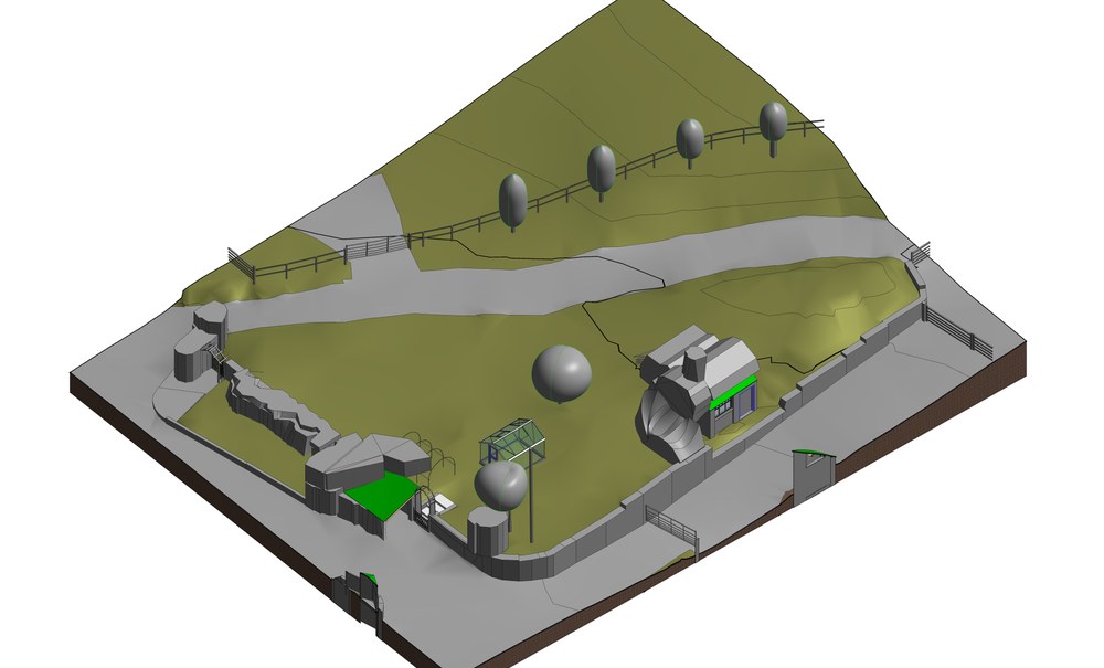
Every topography job starts with classification. Before any geometry is placed, our modelers read the point cloud and decide what each surface is, because that decision sets which Revit tool models it.
| Surface or feature | Typical examples | Revit approach |
|---|---|---|
| Hard surfaces | Sidewalks, concrete yards, driveways, parking lots, curbs | Floors, with sub-element editing and split lines for slopes |
| Soft surfaces | Soil, grass, asphalt roads, general terrain | Toposolid (Revit 2024 and later) or Toposurface (earlier versions) |
| Transitions | Where paving meets planting or verge | Split Surface on Toposurface, or edited Toposolid edges, cleaned so nothing overlaps |
| Site features | Trees, lamp posts, manholes, curb ramps, bollards, drainage covers, road markings | Families placed only where your scope lists them |
Soft terrain is generated by our own Revit add-in, which builds the surface from imported points. That saves the most time on large or irregular ground. A second in-house tool batch-loads custom site families such as bollards and lamp posts.
Setting LOD, tolerance and coordinates
Clients sometimes treat LOD and accuracy as one setting. For site work we ask for both, early.
- LOD: Most site models are agreed at LOD 200 to 300, depending on whether the model supports coordination, grading studies or detailed design. We go to LOD 400 when the specification asks for it.
- Tolerance: Ground surfaces are held to a tolerance you choose per project, commonly 50, 30 or 15 mm, or a custom figure from your spec.
- Coordinates and units: The model follows your survey, which on US sites is often state plane coordinates in feet, and on UK and Australian sites a national grid in meters.
Your Revit version also matters, because it decides whether terrain arrives as Toposolid or Toposurface.
Hidden ground and scan density limits
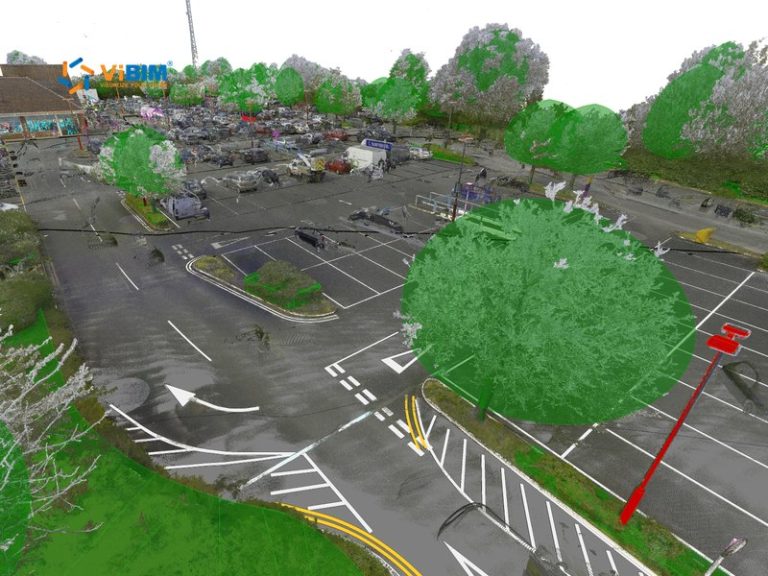
A laser scanner only records what it can see. Parked cars, dense planting and stored materials hide the ground beneath them, and we will not guess at its shape. Those areas are flagged on the model, then completed from your site plans or extra survey points. If neither exists, the area is left out or marked rather than invented.
Scan density matters too. A registered terrestrial scan gives the most reliable spot elevations and curb lines. Data from a mobile scanner such as the Leica BLK2GO is workable, but the lower density limits how much of the site can reach a high LOD.
Large sites are handled in parts. On a 43,000 m² UK site, for example, our team split the parking areas and surroundings into sections, modeled each one, and joined them into one continuous surface.
How we review a site model
QC is done by two independent reviewers, separate from the modelers. They check that:
- Each surface uses the right Revit element for its material and behavior.
- Slopes, curvature and elevations match the point cloud, verified at key spot elevation points.
- Hard and soft surfaces meet cleanly, without gaps or overlaps.
- Naming follows your BEP or Scan to BIM guidelines.
- Visual overlays and deviation analysis show no surface outside the agreed tolerance.
Anything that fails is corrected and checked again before the file goes to you.
What teams do with the model
A site model earns its keep at the interfaces. Combined with the building model, it shows where finished floor levels sit wrong against the adjacent ground. Landscape and paving designers plan against real existing levels, and cut and fill quantities come from comparing a proposed surface with the modeled ground. Measured slopes on ramps and walkways help designers review accessibility, such as ADA requirements in the US, although compliance stays with the design team and approval with the local authority.
Files and how to start
We accept RCP, RCS or E57, registered or not, with survey coordinates and any earlier site plans. Site photos help confirm surface materials the scan cannot show. For a quote, tell us the site boundary, the surfaces and features to include, the LOD and tolerance, your Revit version, whether you need DWG drawings, and your deadline. We reply with scope, timeline and pricing within 12 to 24 hours.
Over more than 1,000 projects, our reusable families and automation have kept turnaround about 30% faster than the market average. If the building also needs modeling, we can quote it from the same point cloud so floor levels and ground levels share one system; see our Scan to BIM services.
To see how your site would be handled, contact us with a sample area such as a parking lot or courtyard. We will model it as a free trial and return a quote for the full site.