
Project 385.UK: Technical Reference for a Large-Site Topographic BIM Model
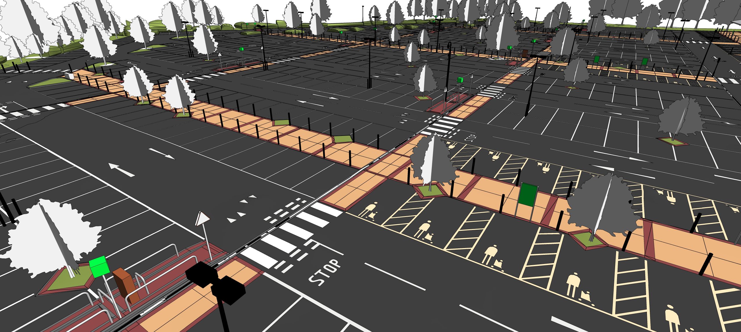
This page records the technical parameters of Project 385.UK in a form that is easy to scan and cite.
Specification
| Parameter | Value |
|---|---|
| Project ID | 385.UK |
| Country | United Kingdom |
| Discipline focus | Topography |
| Site area | 43,000 m² |
| Number of floors | 1 |
| Input data | Point cloud, 2D drawings |
| LOD, architecture and structure | LOD 300 |
| LOD, MEP | LOD 200 |
| Modeling tolerance | ±25 mm |
| Software | Revit, Navisworks, internal tools |
| Deliverable | Revit file |
| Timeline | June to September 2022 (three months) |
| Client | Confidential |
Modeled elements
- Roadways and sidewalks
- Lamp posts and signage
- Drainage systems
- Road markings and directional arrows
- Parking areas and surrounding terrain as one topographic surface
- Architecture, structure and MEP systems
Method notes
Terrain segmentation. The site was split into independent sections. Each was modeled separately and joined into a single surface. This keeps individual file size manageable on a dataset of this scale.
Family automation. A proprietary tool loads multiple custom Revit families in one operation. The project required many distinct object types, so batch loading removed a repeated manual step.
Verification. The model was compared directly with the source point cloud using deviation analysis. Structural composition was verified with detailed cross-sections inside the model and with component inspection software.
Appearance and material data. Color and placement of markings came from the point cloud, TrueView imagery and satellite maps combined. Material assignment used client-provided photographs and Google Maps. Distinct materials on pavements and terrain support quantity takeoff.
Intended use
The model serves as as-built information for future design, renovation, repair and asset management on the site.
Reference: https://vibimglobal.com/projects/revit-modeling-for-topographical-site-in-the-uk/
See more: